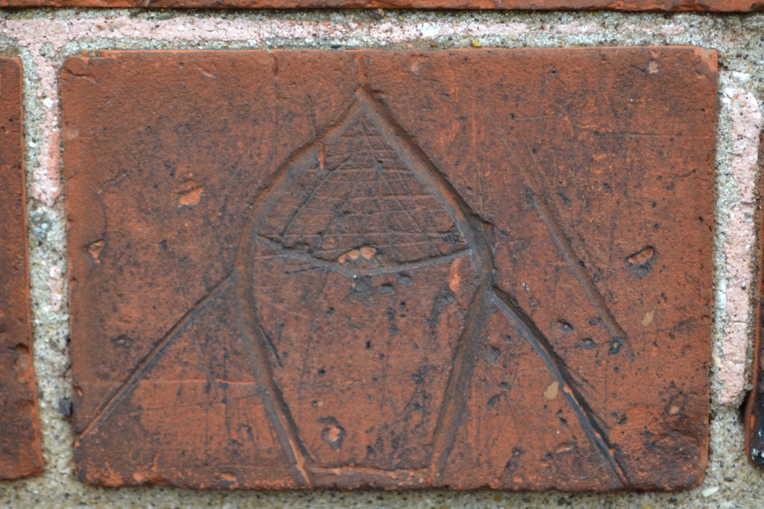
Who Knows What These Are
|
|
Who knows what these are please don't just think its a brick, it is the graffiti we are talking about here, these 2 images most people who live in the village walk by on a regular basis and never even notice it, this graffiti but not all is from the turn of the last century so your looking at 100 year old graffiti, they are located about head hight on what used to be the Old Antique Shop, now i hear you thinking to your self what might it be graffiti of, well for a little fun i will keep every one guessing for now I might let on in a months time, for now why not leave a message over at our blog page with your thoughts what this might be about.
|

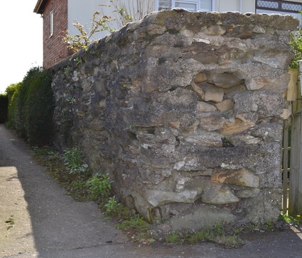
Ottringham Tank Defense Wall
|
Ottringham Tank Defense Wall a well known landmark to most villagers here but for those who don't its opposite Ripon Farm Services, they were placed either side of a road constructed of heavy stones and concrete for strength with a wooden barrier in between and covered with barbed wire, they were manned by soldiers in WWII, and used to transport vehicles and people back then on this important crossroads!! this now lonely barrier is all that remains to remind us of the past.
|
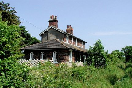
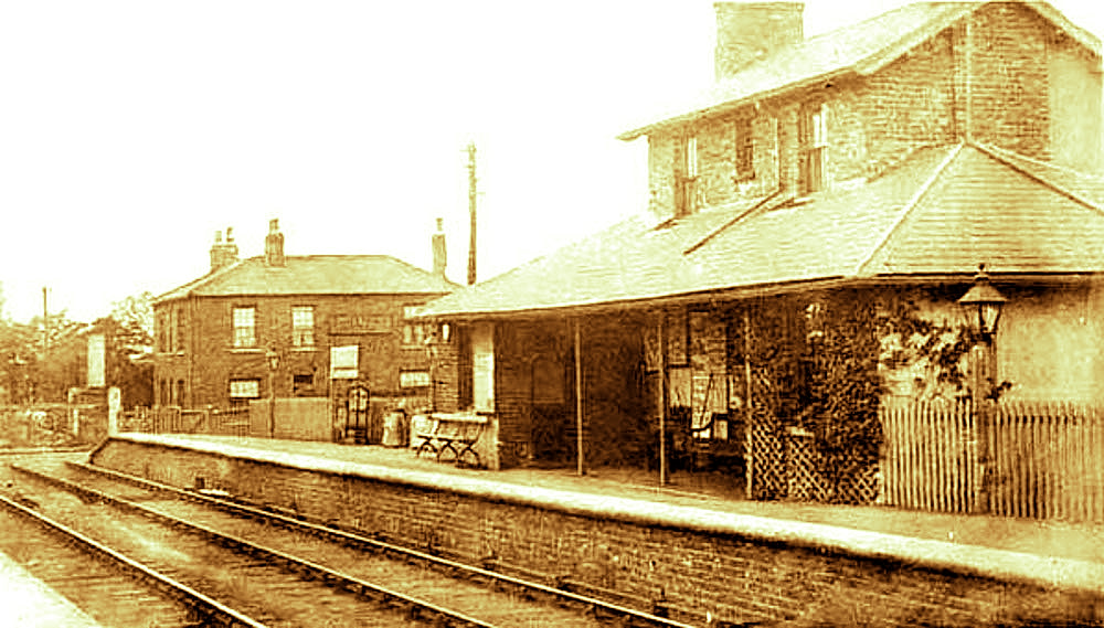
Ottringham Railway Station
|
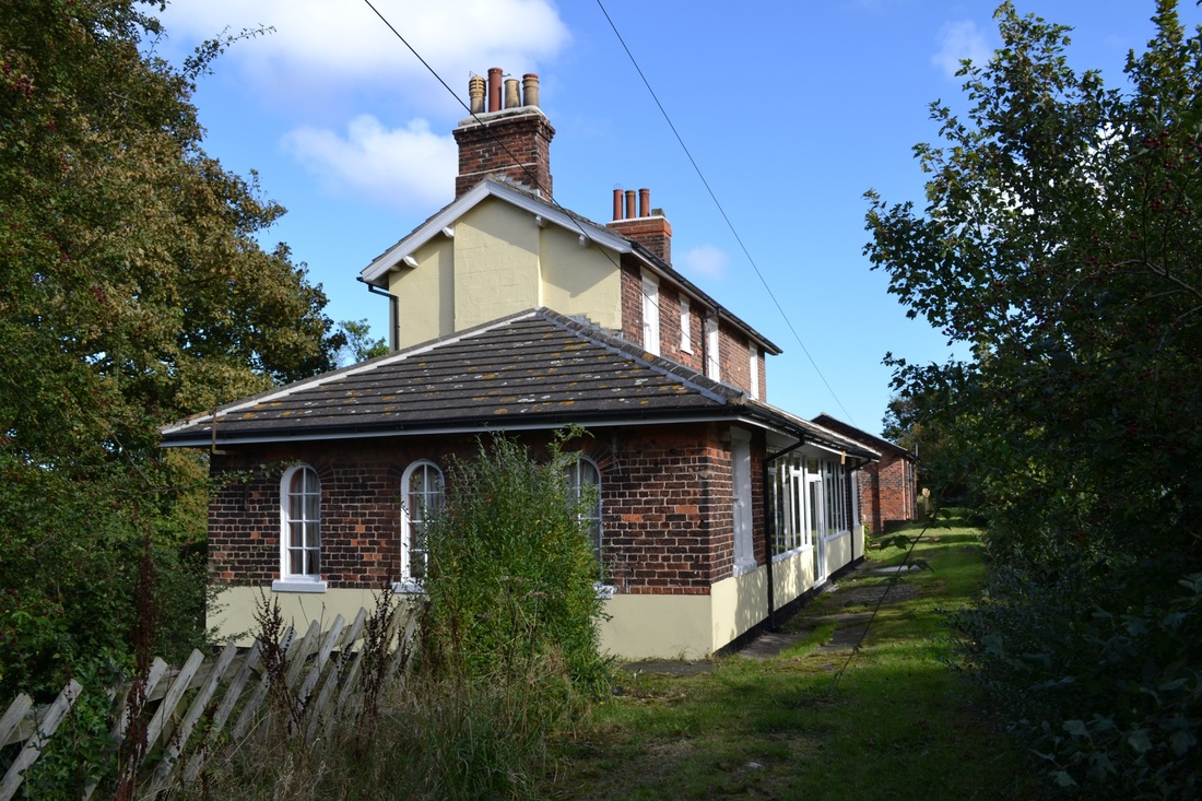
Ottringham railway station is a disused railway station on the North Eastern Railway's Hull and Holderness Railway to the north of Ottringham.
It was opened by the Hull and Holderness Railway on 27 June 1854. and later taken over by North Eastern Railway. The station was closed to passengers on 19 October 1964 and to goods on 3 May 1965. The preceding station was Keyingham and the following station was Winestead or vice-versa if you were traveling in the opposite direction. |
|
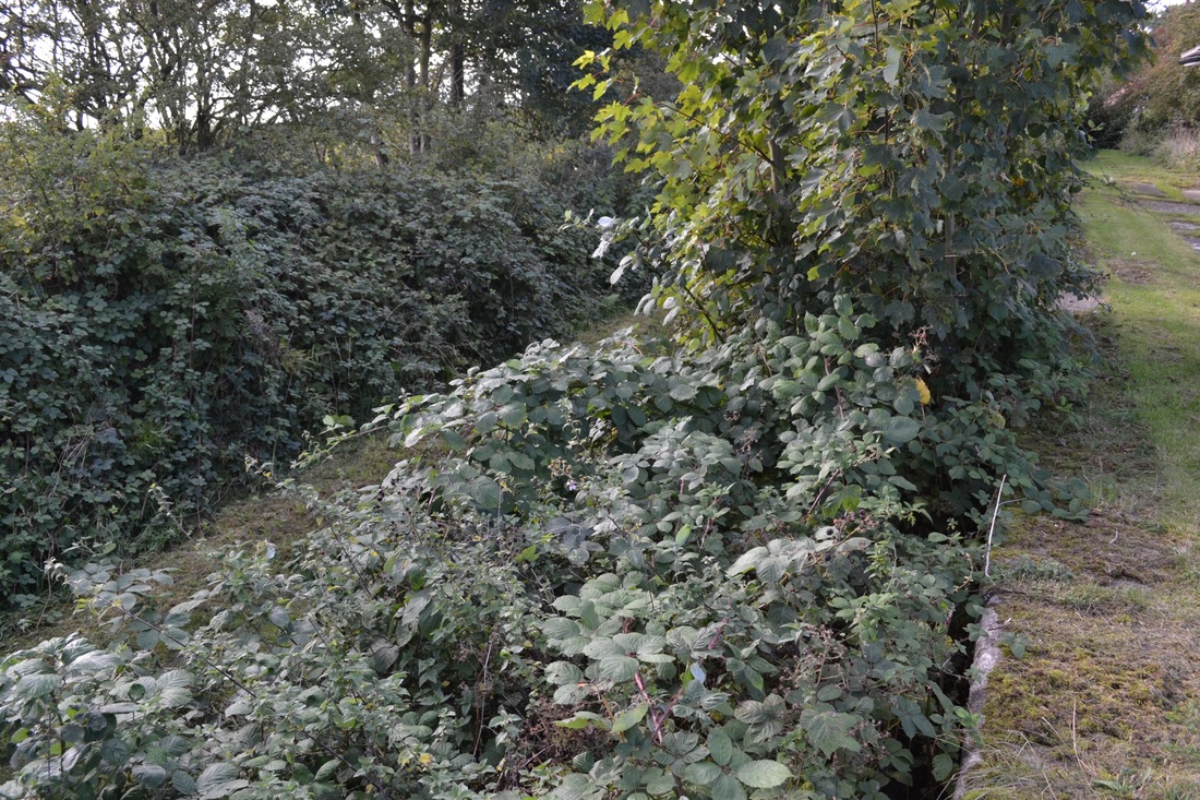
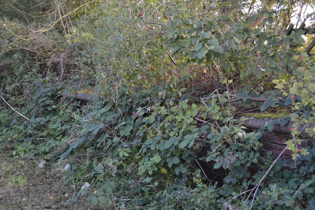
Right a selection of photos of Ottringham Railway Station both past and present, and with kind thanks for letting me photograph to its present owners.
|
      |
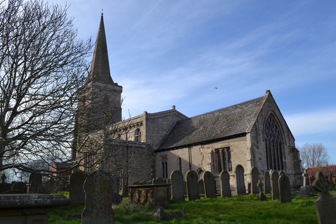
Ottringham Church
|
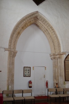
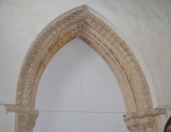
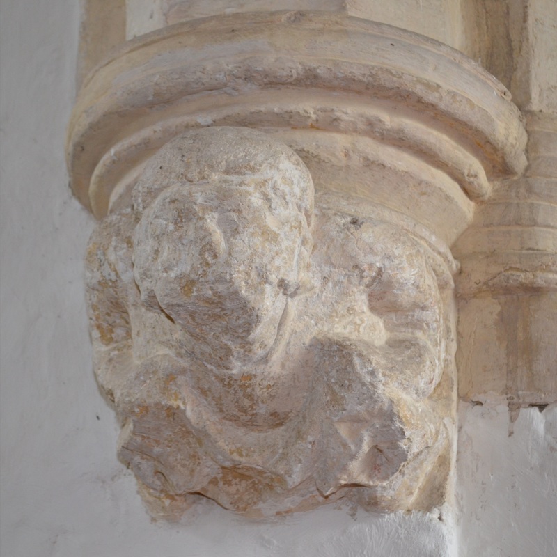
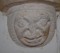
St Wilfrid's church in Ottringham dates to the 12th century, but the current building is largely 13th and 14th century. The tower arch and interior corbel heads remain from the 12th century church. Some of the corbel heads are extremely amusing, with grotesque expressions.
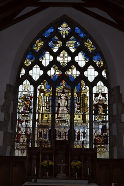
The nave features a very fine king post roof with carved bosses, and the nave floor is filled with Georgian box pews. There is a royal coat of arms over the tower arch, and a 13th century piscina in the south wall of the nave, which indicates the location of a chantry chapel established by Richard of Ottringham on a license from Edward I. And therein lies a story. In the late 13th century Bridlington Priory provided priests to Ottringham, and Richard naturally wanted the Priory to provide a priest for his chantry, to say prayers for his soul and the souls of his family and ancestors. Edward I, however, had bigger fish to fry. The king was involved in negotiations with the Abbey of Meaux to acquire their land at Wyke, on the River Hull. To sweeten the deal he offered Richard's endowment to Meaux. The Abbey agreed, and it was they who provided the priest for Richard's chantry at Ottringham. The king got his hands on Wyke shortly after, which was renamed King's Town upon Hull. The name was soon shortened to its more familiar form, Kingston upon Hull. So you could stretch a point and say that the town of Kingston upon Hull owes its establishment to the chantry chapel of Richard of Ottringham. One of the more interesting features of the interior is one of the most modern. The large east window has lovely stained glass, inserted in 1949 in memory of Leonora Wright. The glass tells the story of the Birth and Growth of the Christian Church in four panels, though it is quite interesting which historical events are included; the final event, presumably the evolutionary culmination of Christianity, is the appearance of John Keble at St Mary's, Oxford - not an event that would make everyone's top four of all time! |
BBC Radio Ottringham
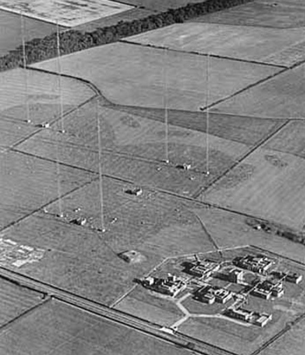
Few people know that Ottringham was the home of many of the BBC’s broadcasts during the war, and that its transmissions were received well into the heart of occupied Europe.
Aerial masts 500 feet high towered up in the sky. Wavelengths were often changed as they coincided with other channels, including a German built station to boost the voice of Lord Haw-Haw and marine distress signals.
Engineers manned the control room desks which were a maze of dials and switches, monitoring all the programmes, the timing of which was most important.
Until then, the BBC had been using their existing transmitter sites at Bookman's Park, Droitwitch and Daventry but this could only ever be a temporary solution while they developed a new east coast site. This consisted of a 94 acre plot with seven buildings and several 500 foot transmitter masts.
The station, which was known as OSE5, had a maximum power of 800 kilowatts either on long wave or medium wave and at the time this was the most powerful transmitter in the world. 4 200 kilowatt Marconi transmitters were installed in 4 heavily protected surface buildings, possibly with earth revetments. These were driven and fed with programmes from a 5th building (the Control Centre) while the 6th building was the Central Combining House which contained the circuits to combine 200kW at a time for the LF service to a maximum of 800kW output.
Although the station was tested to 800kW output it never run on programme to that level, 600kW being the maximum used. The station was designed to broadcast with 200, 400, 600 or 800 kilowatts with up to four separate programmes simultaneously. The forth transmitter was used to relay the Home Service (Radio 4) to the East Riding and North Lincolnshire. The final building on the site was a standby set house with 3 X 740bhp diesel alternator sets. (There was also a garage and a sub-station)
BBC Ottringham continued in service until well after the war but was eventually closed on 15th February 1953 because neither channels nor funds were available for it continue in service. The site was dismantled shortly after closure; the transmitters were moved to Droitwich where they provided service well into the 1970s, for Radio 1 and Radio 4 on medium wave and Radio 2 on long wave. They were installed in three storey buildings; the water cooling plant was below ground, the modulation and rectifier enclosures were on the ground floor, and the AF and RF stages were housed on a first floor gallery. One of the aerial masts is still in use at Brookmans Park (F1 a replacement for F mast that fell down in 1956 while contractors were working on it), the others are believed to have gone to other BBC HF sites. The site of the aerial masts has now been returned to farmland while the transmitter site has been cleared of all buildings. A new industrial unit has been built at one end of the fenced site while the rest is a storage yard and lorry park. Although the site appeared completely cleared of anything to do with the BBC, one section of the basement of the control centre remains intact.
Ottringham Village Institute
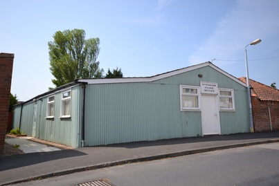
Ottringham Village Institute Corrugated iron building at the top end of Chapel Street. The institute is a charity, the object of which 'is the provision and maintenance of a village hall for use by the inhabitants of the area of benefit, Ottringham and its neighborhood without distinction of political,religious or other opinions, including use for meetings, lectures and classes, and other forms of recreation and leisure time occupation, with the object of improving the conditions of life for the inhabitants. There is a larger village hall just across New Road, but I'm not sure if this comes under the aegis of the Institute.
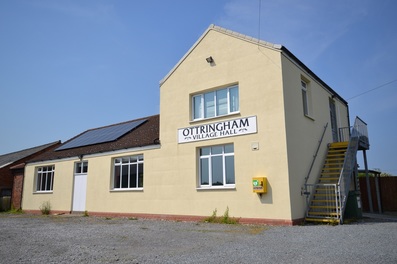
Ottringham Village Hall
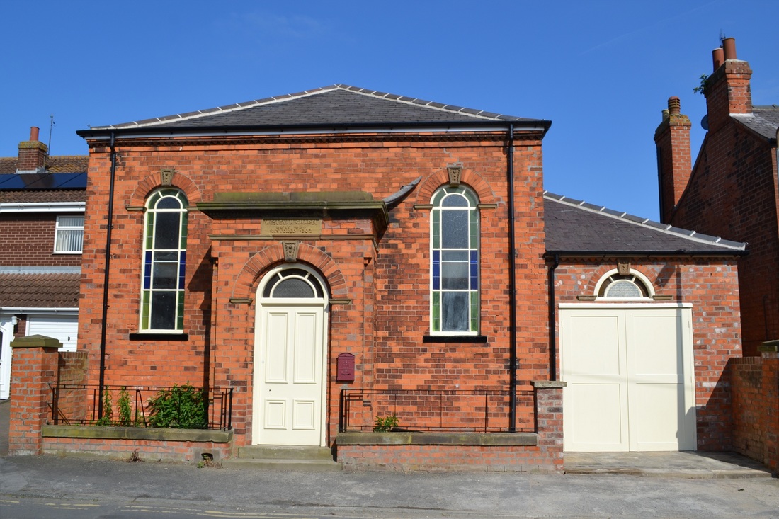
Ottringham methodist Chapel
|
|
The Wesleyan Methodist chapel built in 1815. replacing an earlier building which was then used as a day school. This has now been demolished to make way for new houses. The village school was closed in 1948 and the children are taken by bus to other schools in the area.
|

Wapentake
Wapentake was the rough equivalent in the Danelaw of the Anglo-Saxon hundred. The word is possibly derived from a meeting place, usually at a crossroads or by a river, where one's presence or vote was taken by the brandishing of weapons. According to some authorities weapons were not brandished during a Norse assembly (known as a þing) but were allowed to be taken up again after the assembly had finished. It is also possible that it was just citizens who were entitled to possess weapons that were allowed to take part—an idea perhaps suggested by references in the Germania of Tacitus or current practice in the Swiss canton of Appenzell Innerrhoden.
The Danelaw counties of Yorkshire, Derbyshire, Leicestershire, Northamptonshire, Nottinghamshire, Rutland and Lincolnshire were divided into wapentakes, just as most of the remainder of England was divided into hundreds.
In Yorkshire, a Norse wapentake usually replaced several Anglo-Saxon hundreds. This process was complete by 1086 in the North and West Ridings, but continued in the East Riding until the mid 12th century.
In some counties, such as Leicestershire, the wapentakes recorded at the time of Domesday Book evolved into hundreds later on. In others, such as Lincolnshire, the term remained in use. Although no longer part of local government, there is some correspondence between the rural deanery and the former wapentake or hundred, especially in the East Midlands, the Archdeaconry of Buckingham and the Diocese of York (see, for example, Beltisloe or Loveden).
White (1882), Directory for Lincolnshire, p. 94 described the wapentakes as "now of little practical value". Their potential functions had been taken over piecemeal by other units such as electoral districts, Poor-Law unions and so on.
The term ward was used in a similar manner in the four northern counties of Cumberland, Durham, Northumberland and Westmorland.
In Wales the hundred replaced traditional units such as the cantref or cantred (meaning 'one hundred settlements'), or commote. Irish counties were divided into baronies.